For us to execute the project as envisioned, we need a willing governmental agency to work with BLM for a Recreation Public Purpose Lease. Although stalled, it’s still an important reach of the river for restoration. Projects often go through years of phases and iterations, we look forward to the next phase of this one.
Click here to download a full informational packet including current restoration maps and designs
Our Vision
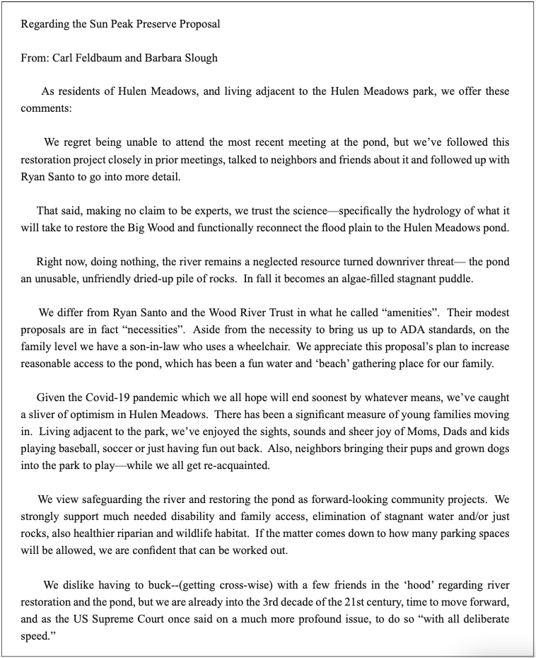
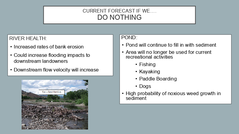
 The proposed Sun Peak Preserve project is a transformative river restoration project. The section of the Big Wood River between the BLM’s Lake Creek Trailhead and the BLM’s Sun Peak Day-use area is one of the most unstable reaches of the whole river. If we do nothing, the river will continue to degrade, harming habitat for fish and other wildlife, exacerbating flooding downstream, and filling in the Hulen Meadows Pond. But together, we can reconnect the river to its floodplain, repair old damage, and restore the pond in a way that can bring the wonder of nature to all members of our community – regardless of physical ability or walk of life.
Letters of Support for the Project
We would like to thank the following community members and groups for their support of this project.
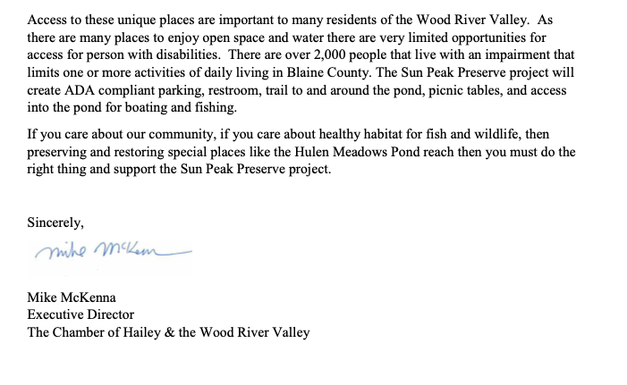
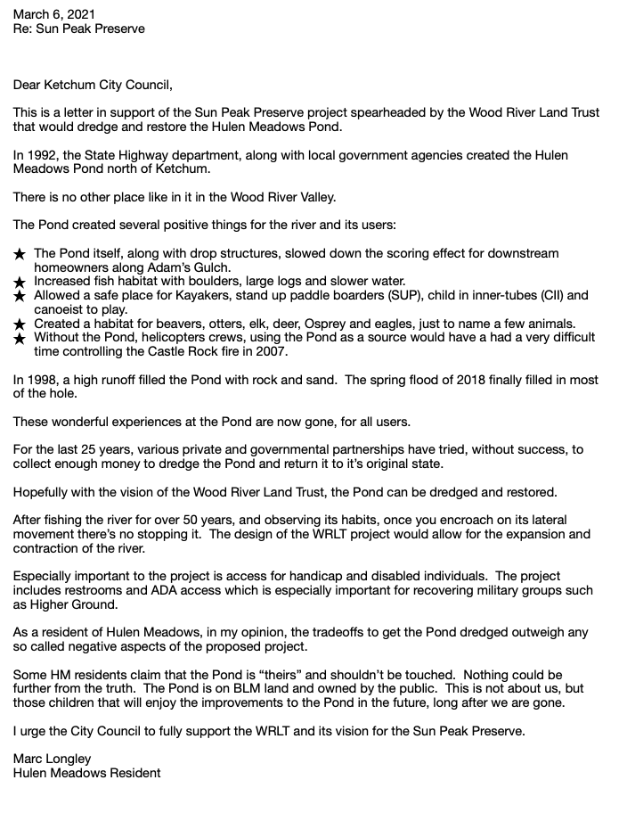
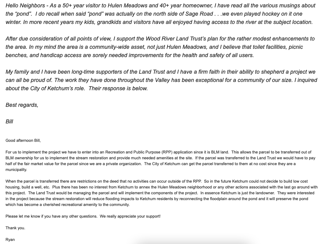
Hulen Meadows Resident
Higher Ground
Hailey Chamber of Commerce
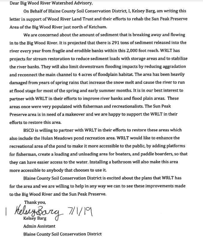
Blaine County Soil District
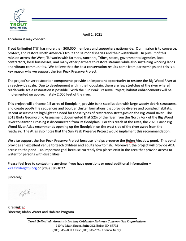
Trout Unlimited National
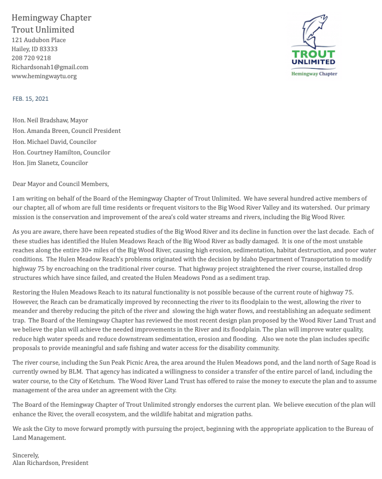
Trout Unlimited Hemingway Chapter
Hulen Meadows Resident
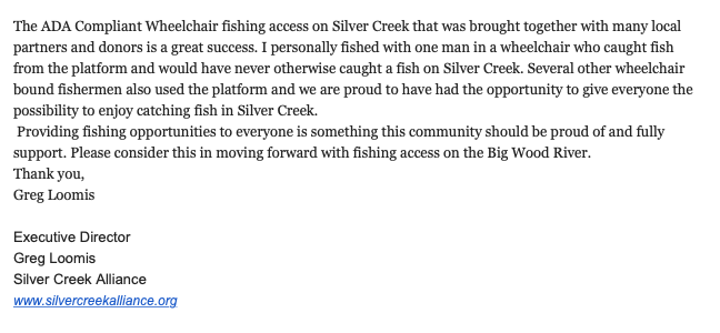
Silver Creek Alliance
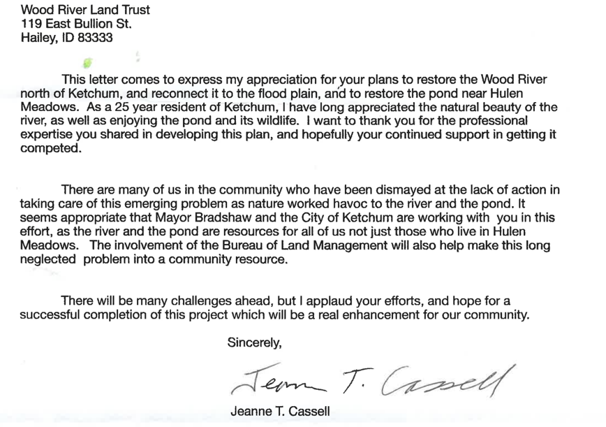
Ketchum Resident
Hulen Meadows Resident
Hulen Meadows Resident
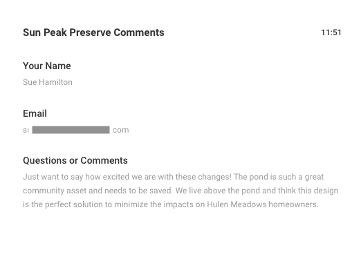
Hulen Meadows Resident
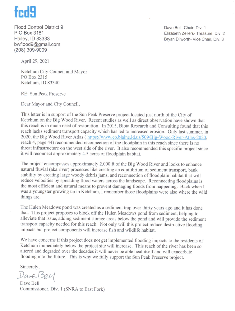
Flood Control District 9
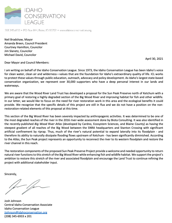
Idaho Conservation League
Project Timeline
How We Got Here: For an overview of how we got to where we are, the timeline below recaps all of the work we've done on this project from 2017-now.
2017-2018: WRLT was approached to help with long term assistance of the pond and surrounding habitat.
WRLT was approached to help with the long term assistance of the pond and surrounding habitat due to the long standing successes WRLT has shown with restoration and stewardship. Hulen Meadows residents paid for a river and pond restoration design drawings by consulting company BIOTA. A stakeholder group of residents, non profits, and government agencies formed to keep the project moving forward. In 2018 working with a group of residents from Hulen Meadows, we developed the stream restoration design.
2019 October: Sun Peak Preserve project stakeholders host first public meeting.
Sun Peak Preserve project stakeholders hosts public meeting. This is a brainstorming meeting where community vision comments were solicited. The BIOTA river restoration plan was briefly mentioned to show the benefits of the habitat restoration. Results of the meeting was that BIOTA should present the detailed river restoration plan to show why the restoration is truly needed in this reach.
2019 December: Second public meeting to present the BIOTA stream restoration design
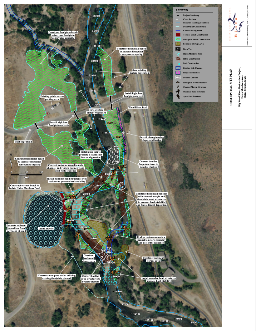
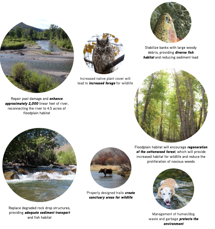
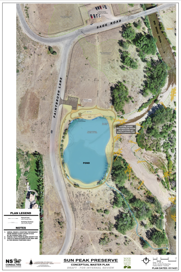
The stream restoration design enhances fish and wildlife habitat, preserves the pond, and allows for natural river functions like appropriate sediment transport to occur to the greatest extent possible. The design encompasses approximately 2,000 feet of river; reconnects 4.5 acres of floodplain habitat; constructs large woody debris structures to mimic natural processes and increase diverse fish habitat; and replaces degraded rock drop structures to allow natural sediment transport. Creating a way to prevent the pond from filling in with sediment will protect this popular recreation amenity and also provide for crucial wildfire mitigation to nearby neighborhoods. The design was developed in late 2018 by Biota Research and Consulting Inc and was presented to the public in December, 2019. More detail can be found on our website.
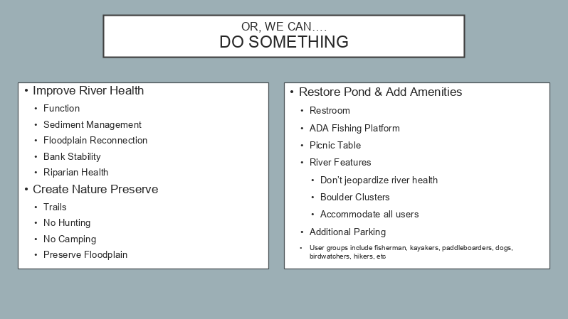
2020 March: Sun Peak Preserve project stakeholders host third public meeting and present two ideas: Do Something or Do Nothing
Sun Peak Preserve project stakeholders host third public meeting and presented two basic options: Do Nothing or Do Something. The Do Something Plan incorporated the ideas from the October 2019 meeting and comments were solicited. The consensus from the meeting was that the river restoration was supported and access amenities needed to be fleshed out for community review.
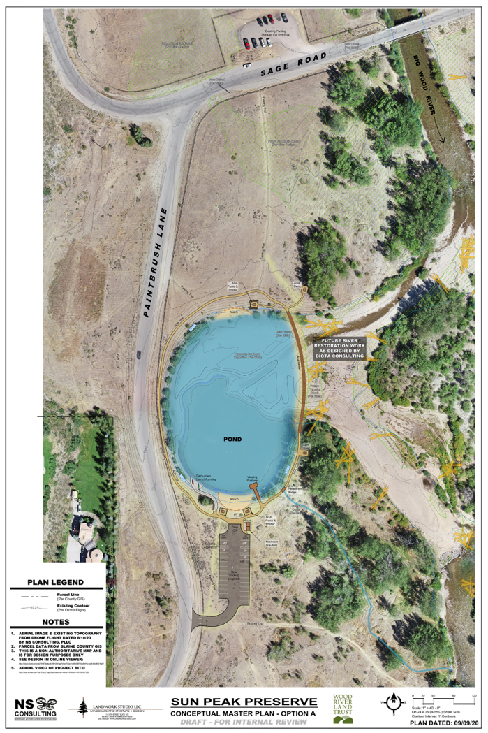
2020 October: Sun Peak Preserve project stakeholders host fourth public meeting with proposed amenities incorporating comments from the March meeting
Sun Peak Preserve project stakeholders host fourth public meeting with proposed amenities incorporating comments from the March meeting. The following three plans were presented at the October meeting:
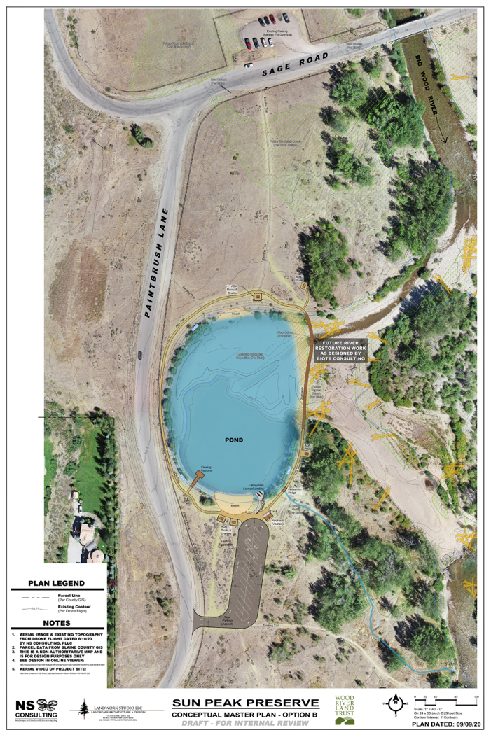
2021: Based on comments from the October 2020 public meeting, amenity designs have been revised
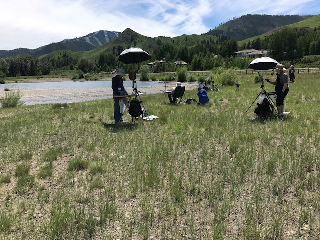
The pond was originally one of many excavation pits used as part of the road construction projects on Highway 75 and, like the others, was meant to serve as a sediment trap. When filled with water, the pond became an amenity enjoyed by many, as the quiet water provided a different experience than the nearby river for activities like learning to paddle board, kayaking, or throwing a stick for your dog. The Sun Peak Preserve project offers the opportunity to restore the pond and ensure access for everyone, regardless of physical ability.
This, most recent plan, has gone through many iterations. We held public hearings, carefully read written comments, and are excited to bring this latest design to the community. Details include: ADA parking (4 spaces) & loading/unloading off Paintbrush Lane north side of pond; One restroom (2 stalls); ADA trail to and around pond - no hardened surfaces; ADA access into the pond via an earthen ramp or other naturalized solution; 2 ADA picnic tables
Read an open letter to the residents of the Hulen Meadows Subdivision that describes how we got to where we are today.
Sun Peak Preserve FAQ’s
The most effective approach to river restoration is to restore and enhance habitat at a reach-wide scale. The Hulen Meadows reach of the Big Wood River was determined to be one of the most degraded reaches of the river in the 2016 river-wide assessment done by Biota. Because such a large portion of this reach is public land owned by the Bureau of Land Management (BLM), the proposed Sun Peak Preserve project provides a unique opportunity to enhance the River on a reach-wide scale.
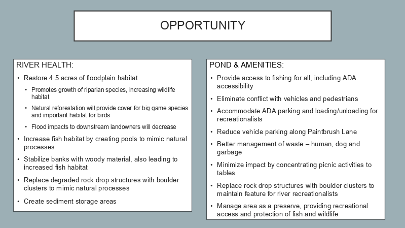
The habitat restoration will enhance floodplain and riparian habitat for fish and wildlife, decrease bank erosion, and provide diverse instream habitat for fish. All of these components will reduce sediment depositing just upstream from the City of Ketchum and thereby will reduce flooding impacts to downstream residents. In 2017, residents from the Hulen Meadows neighborhood asked the Land Trust if there was a way to also restore the man-made Hulen Meadows Pond in the process.
1. What are the goals for the project?
River – Repair past damage and enhance approximately 2,000 linear feet of river
- Reconnect the river to 4.5 acres of floodplain habitat
- Stabilize banks with large woody debris, providing diverse fish habitat and reducing sediment load
- Replace degraded rock drop structures, providing adequate sediment transport and fish habitat
Land – improve habitat for wildlife
- Floodplain habitat will encourage regeneration of the cottonwood forest, which will provide increased habitat for wildlife.
- Better management of noxious weeds will lead to increased forage for wildlife.
- Better management of trails and their use will provide sanctuary areas for wildlife.
- Better management of human/dog waste and garbage will protect the environment.
Community Access- restore the Hulen Meadows pond as a recreational amenity, improve trash issues, and provide access for people of all abilities
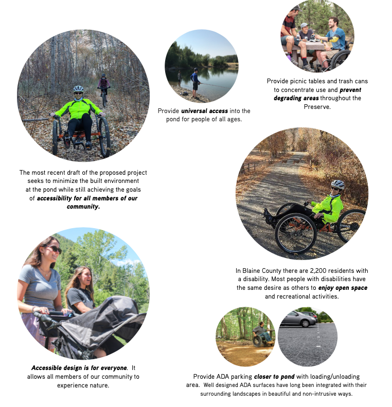
- Provide picnic tables and trash cans to concentrate use and prevent degrading areas throughout the Preserve
- Provide ADA parking closer to pond with loading/unloading area
- Provide ADA accessible bathroom
- Provide ADA access into the pond
2. Why does this reach of the Big Wood River need restoration?
The Hulen Meadows reach of the Big Wood River has been severely degraded from anthropogenic activities such as the installation of the Sage Road bridge which restricts the movement of the river; channelization of the river to protect Highway 75; and dredging from the initial creation of the Hulen Meadows Pond. The impacts from the bridge and channelization have disconnected the river from its floodplain, which is causing increased erosion and inadequate sediment transportation through the system. The result has degraded fish and wildlife habitat and, if it continues, will increase flooding impacts to infrastructure downstream.
3. Why restore the pond if it was man-made to begin with?
The Hulen Meadows pond was originally an excavation pit used as part of the road construction projects north of Hulen Meadows and was meant to serve as a sediment trap. When filled with water, the pond became an amenity enjoyed by many, as the quiet water provided a different experience than the nearby river for activities like swimming with young children, learning to paddle board, or even kayaking. The Hulen Meadows pond is one of the few publicly accessible ponds in our Valley.
4. Other than re-dredging the pond, why are the other recreational amenities proposed?
The Hulen Meadows pond has been enjoyed by the community for years. Unfortunately, the current configuration of the parking area on Sage Road limits access to the pond to people who are physically able to walk 450 feet over natural terrain. The nearest restroom and trash receptacles are at the Sun Peak picnic area or at the Lake Creek Trailhead, both of which are over a half a mile away. Restrooms and trash cans are necessary to ensure that people have access to facilities and to prevent the contamination of the site and waterway.
The proposed amenities focus on providing ADA access to the pond and on managing access to avoid degradation of the area and wildlife habitat. The goals are to provide ADA parking within 150 feet of the pond or less, an ADA-accessible restroom within close proximity to the parking and pond, a trail and access to the water that is ADA or universal-access compliant, and picnic tables and trash cans to concentrate use. One of the recent proposals was to concentrate all parking south of the pond to avoid pedestrians from needing to cross Sage Road to access the site. In response to public comment, we are reconsidering the non-ADA parking and looking for a solution that would allow a minimalist impact while still providing appropriate ADA access.
5. Is there really a need for ADA access in the Wood River Valley?
Yes. The state of Idaho has approximately 222,000 residents with an impairment that limits one or more activities of daily living. In Blaine County there are 2,200 residents with a disability. Most people with disabilities have the same desire as others to enjoy open space and recreational activities. The pond at the Sun Peak Preserve will provide one of the few places in the Wood River Valley where people with disabilities can have access to the water in a safe manner. Follow this link to view census information.
6. Why and how has the Wood River Land Trust been involved?
The Wood River Land Trust works to protect and sustain the treasured landscapes and life giving waters of the Wood River Valley and inspire love of this special place for generations to come. The Land Trust has long been involved in river restoration work throughout the Valley as well as creating and managing public preserves where people can connect to nature and each other. Click here to learn about our other preserves. In 2017, Hulen Meadows residents approached the Land Trust about working together to enhance fish and wildlife habitat in the Hulen Meadows reach, improve natural fluvial processes of the Big Wood River and restore the pond. This project started as a collaboration between Hulen Meadows residents and the Land Trust to satisfy these project goals.
The project has been through a number of public meetings and comment periods and the Land Trust and its partners have adapted the project design in response to each of these comment periods. The most recent draft of the proposed project incorporates comments received to-date, which seeks to minimize the built environment at the pond while still achieving the goals of accessibility for all members of our community. The latest iteration of the proposed plan should be available in early February 2021.
7. Why is the City of Ketchum involved?
The project started with an effort to obtain funding by the BLM for the project design, construction and management of the preserve. While that effort was unsuccessful, the BLM was open to an application to acquire the property under the Recreation and Public Purposes Act. The Act authorizes the sale or lease of public lands for recreational or public purposes to state and local governments and to qualified nonprofit organizations. Here is a fact sheet of the RPP Act information.Under BLM rules, acquisition of the property by a private nonprofit organization like the Land Trust comes at the cost of 50% of fair market value; but acquisition by a public entity comes at no cost. The City of Ketchum is a qualified public entity that could acquire the property at no cost.
While the project is located in Blaine County outside of city limits, the City of Ketchum will benefit from the river restoration that will decrease flooding impacts to its residents, and the preserve will provide an amenity close to the city that many of its residents currently enjoy. The City does not plan to annex the property into the city limits. The project will provide an amenity that is rare in the North Valley: recreational access to the Hulen Meadows Pond and the Big Wood River for users of all abilities.
There have been several public meetings facilitated by the City of Ketchum, and there will be additional public meetings in the future. To view the materials that have been presented at public meetings so far, visit https://www.google.com/url?q=https://www.ketchumidaho.org/administration/project/sun-peak-preserve&source=gmail&ust=1609363799897000&usg=AFQjCNEJoOB3xE0QVuMwEKiqDMMc8B9yag">https://www.ketchumidaho.org/administration/project/sun-peak-preserve
8. Who will manage the project?
Through a proposed agreement with the City of Ketchum; the Land Trust would manage the construction project and eventually the Preserve. The Land Trust has 26 years managing over 26,000 acres of land held as conservation easements and fee title property. As one example, the Land Trust works with the City of Hailey to manage the popular Hailey Greenway, which protects close to three miles of riparian habitat and 450 acres of land along the Big Wood River and Croy Creek. The Hailey Greenway provides trails and access to the Big Wood River, protects fish and wildlife habitat, and provides ADA access to the Croy Creek wetland.
The Land Trust would manage the Sun Peak Preserve in a similar fashion to enhance fish and wildlife habitat by reconnecting 4.5 acres of floodplain habitat and by providing ADA-compliant access to the Hulen Meadows pond. The Land Trust will use its experience in managing land and enhancing habitat to protect the Sun Peak Preserve for generations.
9. Who will pay for design, construction and maintenance of the project?
Donations from Hulen Meadows residents paid for the first phase of the stream restoration design. Wood River Land Trust will look to philanthropic opportunities to fund design, construction, management and long-term maintenance. These funds will be leveraged through local, state, and federal grants. The construction of the restoration and amenities will not commence until there are funds reserved for long term maintenance, as required by the BLM.
10. What is the permitting and environmental protection process before construction can begin?
Currently the Land Trust is in the planning phase of the project. Once the City of Ketchum and the Land Trust finalize project components and obtain input from the BLM on its requirements, the Ketchum City Council will hold public hearings followed by a vote on approval of the City’s proposed application to BLM for acquisition of the parcel under the Recreation and Public Purposes Act. If approved by the City Council, the City of Ketchum will submit the application to BLM. Once BLM transfers the property to the City, its proposed design and construction plan will trigger the National Environmental Policy Act (“NEPA”). That may require an Environmental Assessment and possibly an Environmental Impact Statement, all of which are subject to public comment. The project will require state and local permits as well.
11. What impact will the concept have on residents of Hulen Meadows neighborhood?
While the Hulen Meadows neighborhood overlooks the BLM parcel, none of the proposed habitat restoration, amenities, or access to the ADA parking area will be constructed on property within the Hulen Meadows subdivision. The proposed access point to the Hulen Meadows Pond will be from a public road that has public land on either side of the road and is not within the Hulen Meadows subdivision. The hardscape required of ADA access may have visual impacts on the Hulen Meadows residents that overlook the pond area, however efforts to construct amenities with natural colors and natural-looking materials will be considered to try to reduce these impacts. Members of the general public use the pond now; the difference will be that people with disabilities will now be able to access the pond and there will be active management of restroom and trash facilities to reduce human waste. There are several studies that show living in close proximity to public amenities, like access to water, open space and intact riparian habitat, increases property values. Below are links to articles describing the benefits of living close to recreational access and natural areas.
https://www.inman.com/2015/04/16/6-factors-that-impact-the-value-of-a-home/
http://www.actrees.org/files/Research/parks_on_property_values.pdf
Have More Questions or Comments?
Please use the comment form below and we will get back to you!
